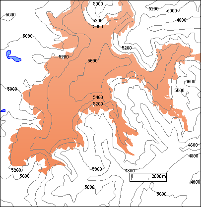
The Quelccaya ice cap is situated in the Cordillera de Vilcanota in the eastern branch (Cordillera Oriental) of the Peruvian Andes. It is near the dropoff to the wet Amazon basin and is among the few large ice plateaus in the tropics (next figure). It has an area of 54 km² and reaches a summit elevation around 5,650 m. Its rim is mostly formed by steep ice cliffs; it feeds only a few outlet glaciers, the largest of which descends to about 5,000 m on the western side of the ice cap.

The Quelccaya ice cap was the object of a multiyear field project aimed at the reconstruction of an estimated 1,500-year-long climatic record based on isotope and microparticle analysis of ice cores. Observations of the modern meteorological conditions and measurements related to the mass and heat budgets were also important components of the project.
The Quelccaya ice cap and environs are clearly depicted on Landsat imagery. Comparison of the Landsat image and the map shows that the margin and structure of this large ice body are remarkably well represented on the satellite image.